Day 6 of our trip to Yosemite last year.
View Larger Map
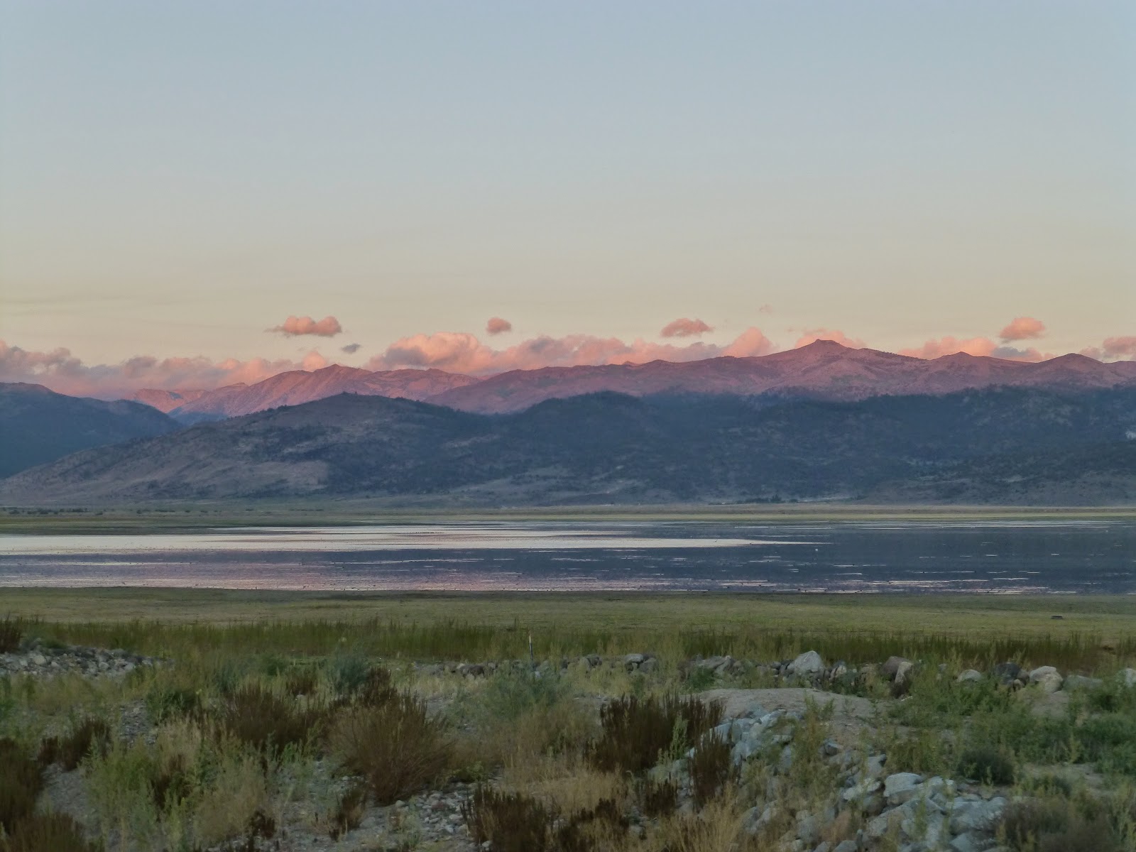
We awoke to the sunrise lighting up the tops of the Sierra Nevada's. This is looking west over the Bridgeport reservoir, towards the Twin Lakes area southwest of town.
After grabbing some coffee and breakfast, in town, we decided to go visit the
Twin Lakes. My family would often vacation here when I was a kid. I can still remember reeling fish into a very small boat with my dad and sister.
Jacob showing us how to properly look in the direction you're turning when making slow maneuvers on a motorcycle. At the end of the second lake is a small resort called
Mono Village. We pulled in to see how things had changed. It still looked the same as it ever did.
Some local wildlife/road hazards were cruising the local establishments while we were checking out the sights.
As enjoyable as the lakes were, we had to continue south along highway 395. This is a small rest area overlooking
Mono Lake.
For some reason the guard rail here is decorated with a lot of stickers.
And I mean _A Lot_! of stickers:)
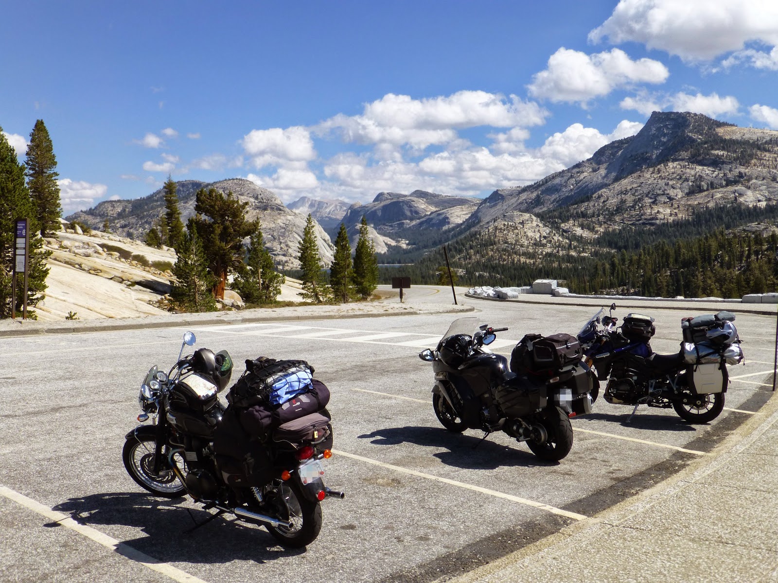
We hopped on highway 120 (Tioga Pass road). This road was closed due to the fire, but you could drive into the Yosemite Park as far as Olmsted Point. You can see the road climbing along the hillside.
The temperature started to drop as the elevation increased.
This is the entrance to the east side of Yosemite. We didn't have to pay the park entrance fee since we still had our receipts from entering the park two days ago.
Along the shores of
Tenaya Lake. Elevation is 8,150 feet.
At the far end of the lake you can barely make out the road cut through solid granite.
I've zoomed in for a better look.
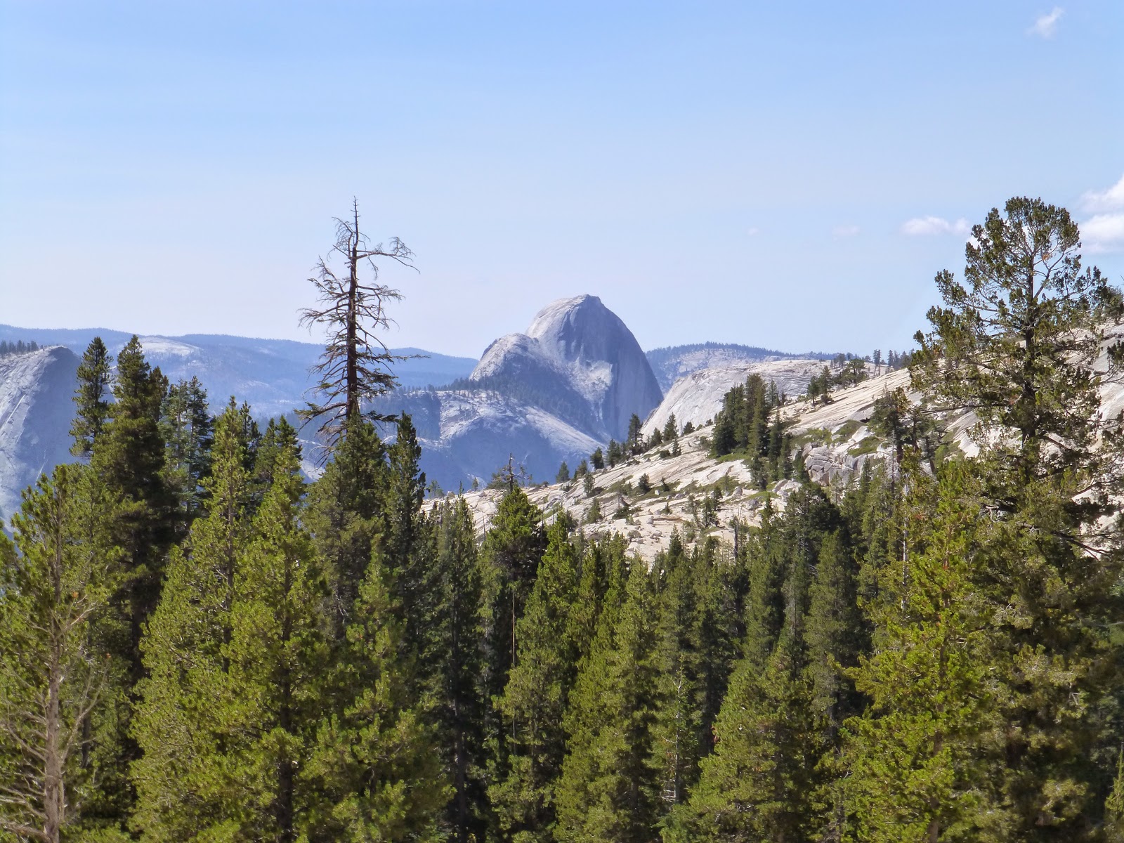
And this is
Olmsted Point. Looking east, where we had just come from, you can barely make out the lake.
And looking west we could make out Half Dome. Kinda cool seeing it from the other side.
Last chilly portion of the trip.
We returned to highway 395 heading farther south, and lower in elevation. It started to get hot.
Looking to the south at
Mt. Tom which stands at over 13,000 feet.
After some long hot stretches of hot pavement, we finally made it back to Ridgecrest where we met up at Greg's house for a delicious dinner. Here I am explaining our trek of California to some of his friends and neighbors.
I'm ready to eat!
They went all out for us! BBQ ribs, beans, potato salad!
The three amigos.
An enjoyable dinner was had.
Found this old picture in Greg's office. I think he said the picture was taken in Poland..I honestly can't remember. Thought it was pretty neat.
Oh hello there Yahoo maps. Guess we'll be using you until Google get's it's act together. The next day Jacob headed back to Oceanside and we headed east to my Uncle's place in Prescott.
Last two photos of the trip was my new bike security system. I'm calling it Pug alarm. Nobody gets close to this bike without being snorted on, and possibly licked. God help you if you're the Mail man.
The next day we headed back home to Tucson. Overall it was a great trip and it looks like the gang is getting back together again this July. Stay tuned for those travels:)


A great conclusion to the trip. SO many great views in those pics, but my favorite has to be the pug alarm. Nice touch. He climbed it, because it was there, lol.
ReplyDeleteDidn't think I was going to finish the trip post there for awhile:) Thanks for reading!
ReplyDelete