Long time, no post. Still working to finish off this trip from last year. I've got a couple of big trips coming up and I need to keep up if I'm going to move this blog along. LOTS of big news here, one of them being a new horse in the stable, but more on that in a later post. For now lets catch up. This was day 4 of our trip and we were heading to the highlight of the trip, Yosemite!. Comments are going to be short and sweet so I can move fast:)
View Larger Map
Packing up the next morning after a good nights sleep. I'm being harassed by the local riff-raff on why it takes me so long to pack my bike.
From Shaver Lake we made a small detour to visit Huntington Lake. My dad had come here on a camping trip when he was in the Boy Scouts. Many moons ago!
This wasn't uncomfortable at all. "Can I get some more personal space please!"
Probably the best lake of the trip. Water was super clear, and no obvious signs of drought. Every other lake in California had signs of shrinkage.
The next cover of "Rugged Men" magazine.
Heading back to Shaver Lake we ran into a spritzing of rain. The only precipitation of the whole trip.
We finally made it into Yosemite!
Off to the north we spotted the first signs of the
Rim Fire of 2013.
The wind was blowing the smoke to the northeast. We came into the park from the south and luckily the Yosemite valley was clear.
We drove to a lookout called Glacier Point for a scenic view of the valley.
My parents had brought us here on vacation a looong time ago. As a kid you don't really comprehend the big picture, or at least I didn't. As an adult you're amazed at what this earth has to offer.
From Glacier Point you can look straight down into the valley. This is the west end.
Panning to the right.
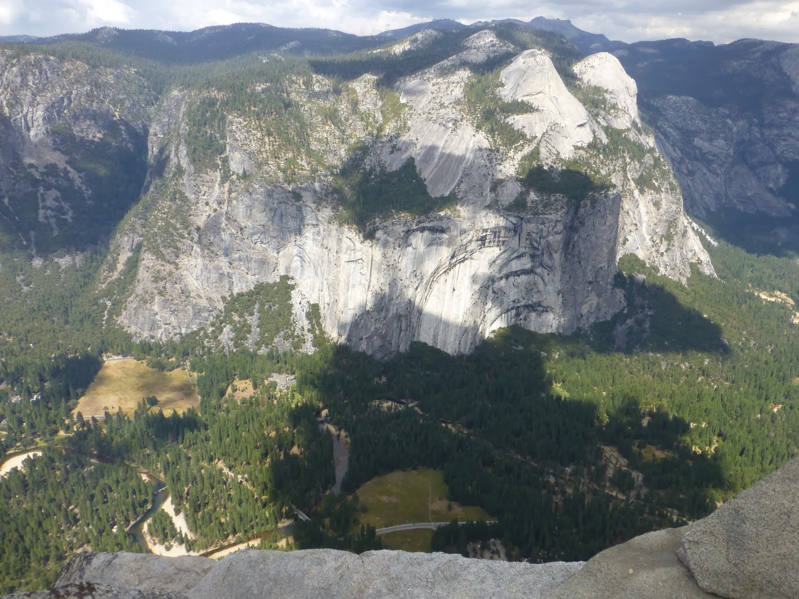
More to the right. Notice the lodge down below. You can make out a pool.
And then looking east towards
Half Dome. In two days we would approach this valley from the east on Tioga pass. The road was blocked due to the fire, but we could still see Half Dome from the opposite side.
Clouds were moving pretty fast over the valley. You could see down pours off in the distance but nothing where we were standing.
This is looking north, towards the Rim fire, with no zoom.
We finally left Glacier point and headed down into the valley. After going through a tunnel you come out to this view.
El Capitan is the large rock face on the left.
Bridalveil Fall is the brown smudge on the cliffs on the right. No water was running when we were there. And Half Dome is center of the photo, wayyyy in the back.
After checking out the sights we headed west out of the valley. Highway 120 was closed, due to the fire, so we had to head southwest on 140. In 2006 there was a bad
rock slide that buried the road. A workaround was setup, but it's one lane only. So we waited our turn to proceed.
We spotted a KOA right before the town of Mariposa. It was a nice find. Still high enough in elevation that we weren't sweating.
Some of the local wild life came out to greet us.
More to come!


I am glad you are continuing with the trip report. I can't believe how clear that lake is. Such awesome reflections.
ReplyDeleteAnd what is this about a new horse (bike) in the stable???????
Thanks for sticking with us! I would have had another post out tonight, but Google had to go and change how the maps worked. *Shakes Fists at the Google folks*
ReplyDeleteAll I can say about the new horse is Kiri had a lapse of reason and allowed me to go pick a real trophy of a bike;)
The condition of the new bike, is that he can't get rid of Bonnie.
ReplyDelete