At the end of August I took a road trip with my Dad, and good friend Jacob, through the Sierra Navada mountain range. This trip was concocted over instant messenger while at work. I believe it started off with Jacob stating that if he didn't get out on the road he was going to lose his mind. The sad fact is that Jacob lost all his marbles a long time ago. Luckily for him it's not hard to talk me into a road trip, so I didn't have to argue his sanity situation. Dates were picked and our primary goal was to visit Yosemite Valley.
This was before all the
fires broke out in California. As we approached departure day it seemed the only stories the news would run was how bad the fires had become. I kept checking the online fire maps and our planned route led us right to them. After much hemming and hawing we decided to continue with the destination, but we'd play it by ear and detour when necessary. So on August 31st my dad and I left Tucson for the long haul to California. I was in a non-photographic mood when we left, so I don't have any pictures of departure morning or the Shell station in Gila Bend. Please see any of my previous posts, where I headed west, to get the gist of Day 1.
The only hiccup was when we reached the southern entrance to Joshua Tree National Park. The plan had been to cut through the park and come into Yucca Valley from the east. Unfortunately a bad storm had rolled through the area and washed out the road. The southern entrance to the park had been closed. So we continued west on I-10 through Indio and Palm Springs. This was a nightmare scenario. Never venture into the Palm Springs valley, on a motorcycle, in late August, in the afternoon! My dad's bike registered the ambient temperature at 113, but my own personal recollection was somewhere closer to 220 degrees! Luckily we climbed in elevation heading into Yucca Valley and by the time we reached the hotel the temperature wasn't too bad. Even so, we had to jump into the hotel pool to bring ourselves back to normal.
Day 1 - 417 miles
View Larger Map
After cooling off we headed over to Jacob's dad's place for dinner. I had met Mac (Jacob's dad) earlier in the year when Jacob and I had explored the Yucca Valley area. You can read about that trip
HERE. Mac was as cool as ever and it wasn't long before we all had cold beers in our hands and discussing our plans for the next few days.
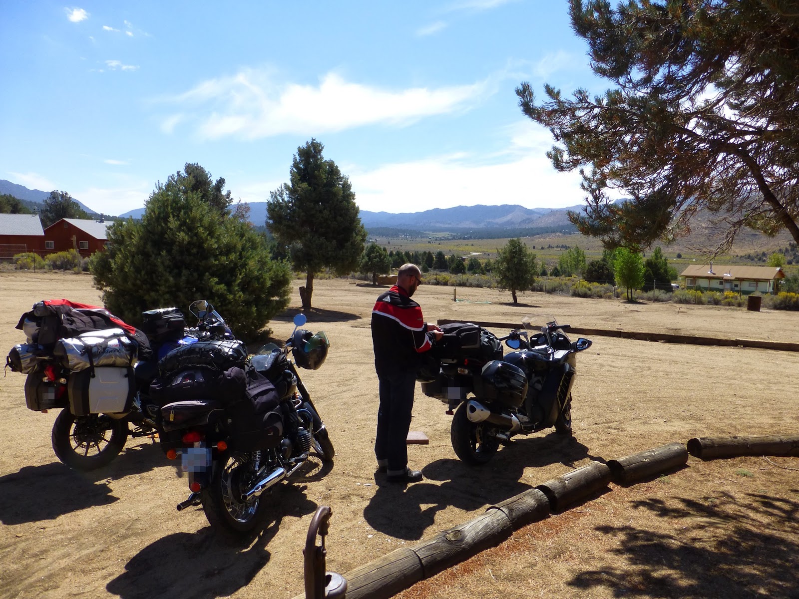
Our only mode of transportation for the next week. Jacob's Connie 14, my Bonnie T100 and my dad's Explorer 1200. Anyone with any motorcycling experience will immediately pick out the Bonneville as the best looking bike between the three.
I gave my dad the tour of Mac's property while teriyaki steak was being grilled to perfection by Mac himself!
Overhead, interesting cloud formations drifted by, as the temperature turned perfect and it ended up being one of those amazing desert evenings.
Dinner was served outside, and it was just what we needed after a long ride! We gave our complements to the chef!
Purry, the cat, mentioned that we didn't have to clear our plates. They'd be taken care of....
The setting sun provided us with an beautiful light show. My dad and I said our goodbyes and we headed back to the hotel. The next morning the three of us would start our trek into the mountains.
Day 2 - 330 miles
View Larger Map
The next morning we met Jacob at a gas station, outside of town, and proceeded to head north. Once we reached Red Mountain we pulled over so my dad could call some old highschool friends of his. We were going to meet them in Inyokern and then follow them up into the Sierra's for lunch.
We met up with Duane and Greg, you'll meet them later, but they were nice enough to buy us some Subway sandwiches at this Shell station. I'm including the picture as you'll notice the mountains in the background. These are the foothills of the southern Sierra Nevada and we headed straight up from here on a road called 9 Mile Canyon.
As we were following Duane and Greg I didn't have a chance to stop for photos. I found this picture, posted on Google maps, showing the road winding up into the hills. It was an amazing ride up. If you're ever in the area be sure to check it out.
Greg's
brother has a cabin at the top of 9 mile in a small community called
Kennedy Meadows. We stopped here for lunch.
Jacob checking his bags to make sure he hadn't lost any luggage after all that canyon carving he had just completed. Well, he _would_ have been canyon carving if he hadn't been trapped behind me the entire ride up.
Ahhhh! it's finally nice to get out of that desert heat!
The inside of the cabin looked like a 5 star resort. If we didn't have a schedule to keep it would have been nice to kick back with a roaring fire and a few beers that evening.
As we made short work of lunch my dad caught up with Greg and Duane. We heard quite a few stories of the old days.
After lunch we headed west on Sherman Pass road. Greg and Duane asked if they could following along for awhile. We welcomed the company. This is at a overlook just south of Sherman peak.
The mountain off in the distance is
Olancha peak. 12,192 feet in elevation.
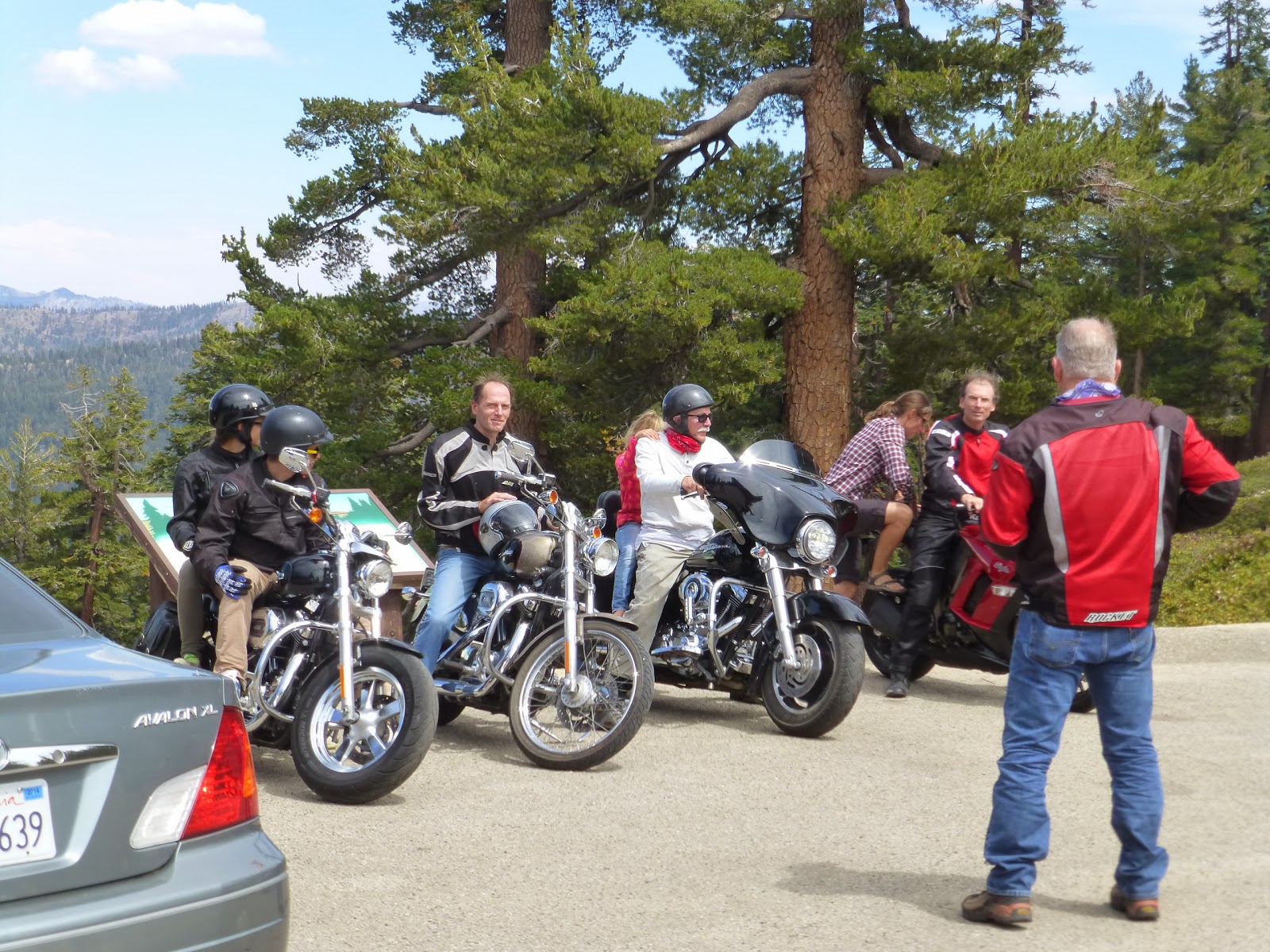
There were a group of foreign visitors here who had rented Harleys for their summer vacation. They asked if my dad could take their photo.
Since we were taking group photos it was only natural to grab one of the three amigos. It doesn't get any more rugged or chiseled looking then this.
From the pass we dropped back down in elevation to where Sherman pass road meets up with the Kern River highway. It was Labor day weekend and this spot is a big recreation area for the locals of Kernville and Bakersfield. The parking lot was packed but the park rangers allowed us to squeeze the bikes into a no parking zone so we could go grab some photos.
Looks pretty relaxing down there.
From here we made our way down the western foothills on some very nice back roads. I wouldn't had found them without the
Butler maps I brought along. This was my second trip with the maps and I don't think I ride without them now. A lot of cool country was seen but I didn't take many photos. We were in a rush to make camp before nightfall. We finally made camp in the town of Three Rivers.
That evening we walked across the street and grabbed some burgers at the
We Three Restaurant and Bakery. It was a great day of riding but I was eager to see the Sequoia National Park the next day.
Part II coming soon. Stay tuned. Thanks for reading.


Those sunshine and warm temperature pictures are so welcome right now as we sit at 6˚F this morning.
ReplyDeleteIt looks like you guys are having a good time even with those boiling temps through the Palm Springs Valley.
@Trobairitz - Wow I wouldn't be able to handle those temperatures:) If I had to go outside for any period of time I'd turn into a shivering lump that would slowly ice up.
ReplyDelete