I was chomping at the bit to start day 4. Our goal was to go through Rocky Mountain National Park and end in Estes Park. We were going to cover around ~320 miles and I was worried we'd run out of daylight while in the park.
View Larger Map
Leaving the hotel in the morning. I knew it was going to be chilly, so this was the first day I wore jeans under the mesh pants. If I remember correctly I threw on that sweatshirt, sitting on my bag, before I left town and it was a good thing that I did.
Vern is big into Geocashing. If you don't know what that is check it out: Geocaching. Anyway he had a goal of finding a Geocach in each state that we visited. So before heading off we stopped to find one in Delta. Apparently all of the geocach's in Delta are located near murals. Hence where Vern found one across the street.
Dr. Quinn and Starr headed back to Tucson early so Starr could make it back to work on Monday morning. So from this point forward it was just Vern and I. It worked out pretty well, Vern and I have similar personalities so we just took our time and stopped for photos when we felt like it.
It didn't take long after leaving Delta that we started gaining altitude entering the Grand Mesa National Forest. I didn't expect to hit high altitude so quickly. It was a bit chilly going uphill as I only had on my summer gloves and light sweatshirt on under my mesh jacket. With the wind chill of riding the bike, it got cold fast! I didn't know it at the time but we had reached 10000' elevation in no time and I started to see snow on the ground. Vern pulled over into a parking lot and I couldn't believe there was a lake with ice! This is Cobbett lake.
Surprisingly, once we got off the bike it felt warm. The sun was still out and the wind was calm. I quickly threw on my jacket's windbreaker and thermal liner on for the next leg of the trip and switched over to warmer gloves. Vern hit the restroom at the ranger station and it was a good thing that he did. He mentioned to the rangers, working there, which way we were headed and they let him know our intended path hadn't been snowplowed yet. We'd have to hit the interstate a bit earlier then intended.
I was a little hyped up after seeing snow. It didn't feel like it was in the forties. Keep in mind I'd been in 100 degree weather just two days earlier.
King of the Mountain!, of dirty snow.
We took a service road behind the ranger station to see the numerous lakes in the area. This one is called Deep Ward lake.
We caught a little rain leaving Grand Mesa. We threw on our rain gear and headed north to catch the freeway at De Beque. I wanted to avoid as much interstate as possible on this trip but it couldn't be avoided. I-70 cuts across some pretty steep terrain and taking side routes would have taken to much time. Of course it wouldn't be a trip with out hitting road work. They had closed one side of the freeway and we had to wait our turn while traffic in the opposite direction could pass. The Colorado river is off to the right of this freeway and man! was it running. We saw numerous rafting tour groups that looked like they were having a ball.
We had wanted to get gas in the town of Wolcott, but when we got there it wasn't much of anything. To make matters worse It had started to rain hard. We continued on to the town of Edward, where we filled up with gas and ducked into a BBQ place called Kirby Cosmo's BBQ Bar. The staff there were really nice. They let us throw all of our gear out to dry and even took a look at our map and gave us tips on which roads to take. It turns out that one of the roads we were supposed to use was dirt. Vern doesn't drive on dirt so we came up with a detour that didn't add too much time.
After a few hours of driving we finally hit the road that led into Rocky Mountain National forest. Quick shot with all my rain gear on. Notice the helmet hair.
It didn't take long to find elk. Prior to taking this picture I had my first scary moment on the bike. Vern had motioned to pull over to snap some shots and I proceeded to do a quick stop. Either the disc brakes or the tire rubber were a bit to cold and the rear wheel locked up on me. One instant I was breaking and the next my rear wheel had swung out to the right and the bike was close to high siding. I released both rear and front brakes and the bike centered up again. Gave me the shakes for the next hour or so.
This shows the valley that you drive into entering the park from the west side. We quickly started climbing in elevation.
Soon we hit the continental divide. The snow drift on the side of the road was still 9-10 foot high. Making it to this location was probably the highlight of the trip for me.
At this point Vern and I assumed we'd be headed down the mountain towards Estes Park. Little did we know that you keep climbing in elevation.
Pretty soon we were above the tree line and in a alpine tundra zone. Clouds started to roll in and it started snowing! Vern was getting worried about ice on the road so we made a beeline down the mountain. At one point I saw a sign stating 12090' elevation.
As we came down the mountain snow turned to rain and we arrived in Estes Park wet and in the dark. Luckily we found Ed's Cantina and Grill. Nothing fixes rain like a nice burger and beer.
Tomorrow, Nebraska and Kansas!
Monday, June 27, 2011
Saturday, June 25, 2011
2818 miles on a Bonneville - Day 3
Day 3 was about 250 miles total. We started the morning exploring the Arches National Park and then headed to Delta, Co.
View Larger Map
After breakfast we headed north. The entrance to the park is just outside of town. I think it cost 10 dollars to get in. This is a good picture as you can see highway 191 off to the left, the visitor's center/entrance to the park, and main road leading up. I had to keep splitting my attention to the sights and then back to driving the bike. Stopping quickly a couple of times because I was gawking at the massive stone cliffs and not watching what I was doing.
Had to throw this in to show the bikes. Dr. Quinn's is up front, the Bonnie in the middle, and Vern's behind that. Dr. Quinn's bike has over 125 thousand miles on it believe it or not. There were supposed to be a few more people here. But you know how it goes, as the actual event nears people back out. Didn't bother me, the fewer the people, the more relaxed trip in my opinion.
Looking south, back towards town.
Who is that masked man?? What a sharp dresser.
We drove farther into the park and found an area with camp grounds and fire pits. It must be amazing to camp here in the fall or spring. The stars would be amazing!
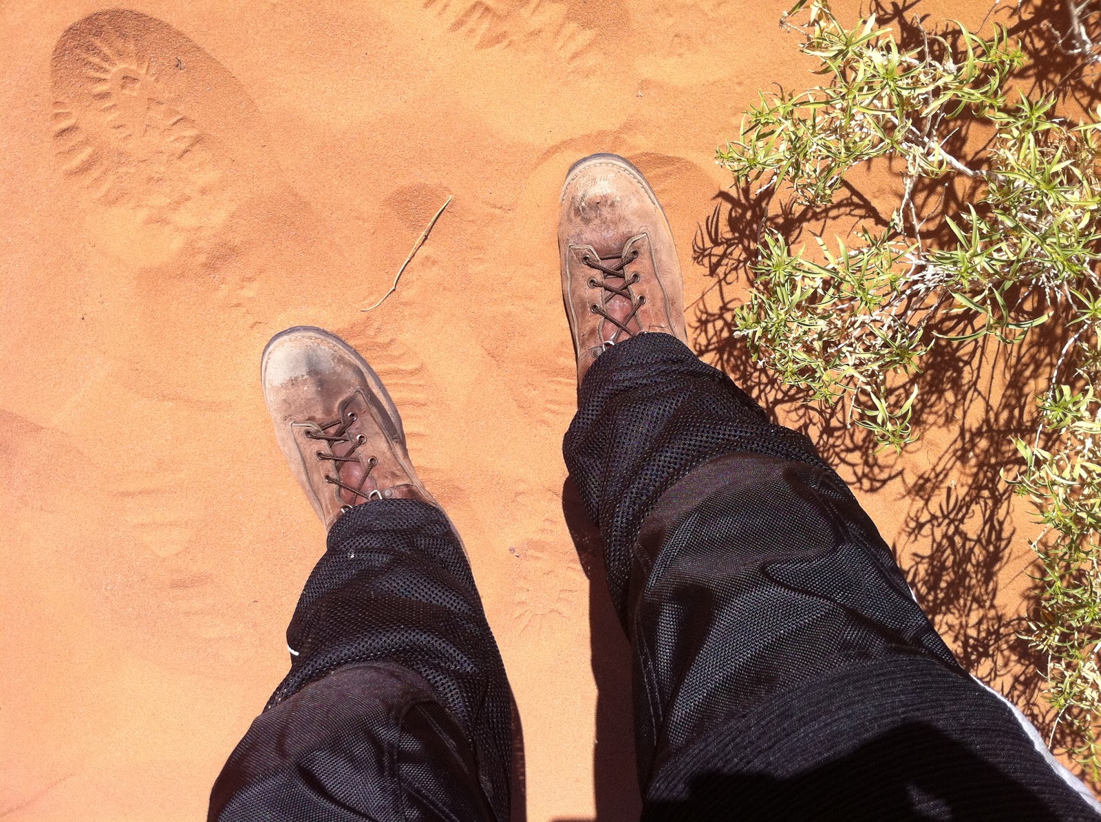
My artistic photo of the day. The sand comes from the surrounding sandstone cliffs. I'm wearing my old hunting boots. They're really comfortable on the bike and I didn't want to risk wearing brand new boots on a long trip.
View from the top.
And behind me was "Skyline Arch". This is the view from behind it, hence the campgrounds and water tank etc.
We buzzed over to the vista point of "Delicate Arch". There is a trail that will take you all the way to the arch, but the parking lot was full, plus it was starting to heat up, so we took a small hike to get the distant camera shot. You can see the arch on the far left to give you perspective.
In the close up, you can see the tourists that hike out to it. Looked to me like there was a line to the right where people were waiting to be by themselves in the center of the arch to get their picture taken. If you want to see some really spectacular shots of this arch just search Google images.
Last stop before we left the park was "Balancing Rock". This thing was amazing!
Dr. Quinn and Starr on the right. Vern was taking the photo.
Pictures and words can't express how cool this place was. You need to go there for yourself!
Exiting the park we traveled south and east, over the La Sal mountain range. I was so caught up with just enjoying the ride I took very few, ok.. maybe _none_, pictures on the rest of this leg. Which is a shame since it was so beautiful. We dropped down into the Unaweep Canyon and followed the Dalores river up through Gateway and east to I-50. I found two pictures on the web that really show what I remembered seeing of the canyon. I didn't take these so I'm linking where I found them. (Source)
We passed a pretty ritzy looking resort in Gateway. I'm linking it here for anyone who really wants to get away from it all for a few days:)
We caught some rain passing thimble rock point, but by the time I put my rain jacket on it has passed. Coming into Delta we hit some strong winds. The locals told me it seemed to be constantly windy lately. Little did I know the winds in Texas would make the Colorado winds seem like soft breezes.
Tomorrow, the best part of the trip for me. Rocky Mountain national park!
View Larger Map
After breakfast we headed north. The entrance to the park is just outside of town. I think it cost 10 dollars to get in. This is a good picture as you can see highway 191 off to the left, the visitor's center/entrance to the park, and main road leading up. I had to keep splitting my attention to the sights and then back to driving the bike. Stopping quickly a couple of times because I was gawking at the massive stone cliffs and not watching what I was doing.
Had to throw this in to show the bikes. Dr. Quinn's is up front, the Bonnie in the middle, and Vern's behind that. Dr. Quinn's bike has over 125 thousand miles on it believe it or not. There were supposed to be a few more people here. But you know how it goes, as the actual event nears people back out. Didn't bother me, the fewer the people, the more relaxed trip in my opinion.
Looking south, back towards town.
Who is that masked man?? What a sharp dresser.
We drove farther into the park and found an area with camp grounds and fire pits. It must be amazing to camp here in the fall or spring. The stars would be amazing!
My artistic photo of the day. The sand comes from the surrounding sandstone cliffs. I'm wearing my old hunting boots. They're really comfortable on the bike and I didn't want to risk wearing brand new boots on a long trip.
View from the top.
And behind me was "Skyline Arch". This is the view from behind it, hence the campgrounds and water tank etc.
We buzzed over to the vista point of "Delicate Arch". There is a trail that will take you all the way to the arch, but the parking lot was full, plus it was starting to heat up, so we took a small hike to get the distant camera shot. You can see the arch on the far left to give you perspective.
In the close up, you can see the tourists that hike out to it. Looked to me like there was a line to the right where people were waiting to be by themselves in the center of the arch to get their picture taken. If you want to see some really spectacular shots of this arch just search Google images.
Last stop before we left the park was "Balancing Rock". This thing was amazing!
Dr. Quinn and Starr on the right. Vern was taking the photo.
Pictures and words can't express how cool this place was. You need to go there for yourself!
Exiting the park we traveled south and east, over the La Sal mountain range. I was so caught up with just enjoying the ride I took very few, ok.. maybe _none_, pictures on the rest of this leg. Which is a shame since it was so beautiful. We dropped down into the Unaweep Canyon and followed the Dalores river up through Gateway and east to I-50. I found two pictures on the web that really show what I remembered seeing of the canyon. I didn't take these so I'm linking where I found them. (Source)
We passed a pretty ritzy looking resort in Gateway. I'm linking it here for anyone who really wants to get away from it all for a few days:)
We caught some rain passing thimble rock point, but by the time I put my rain jacket on it has passed. Coming into Delta we hit some strong winds. The locals told me it seemed to be constantly windy lately. Little did I know the winds in Texas would make the Colorado winds seem like soft breezes.
Tomorrow, the best part of the trip for me. Rocky Mountain national park!
Friday, June 24, 2011
2818 miles on a Bonneville - Day 2
Day two would end up being the longest leg of the trip at ~370 miles but I wasn't aware of the distance at the time. I was to excited about being out on the open road on my own.
View Larger Map
Before we left the hotel we fueled up on a small breakfast. The odd looking item in front is a German pancake. Sort of a cross between a pancake and a omelet. I've found a recipe online if you want to try it yourself. It was very good with syrup and powdered sugar.
My goal was to stay off the freeways as much as possible. Instead of going up to Holbrook and over to US-191, my dad and I headed over to the town of St Johns. Here we parted ways. I headed north and he continued south, back to Show Low. I wish he could have come along but he had to get back to work and the dual sport doesn't make for a great touring bike. He may correct that soon.
It was smooth going, and fun, to be out on the open road. I fueled up in Sanders and made the short hop on the interstate over to 191 north. I remember a few people taking long looks at me as they passed on their way to destinations unknown. It was good to be on the bike and not looking out from the inside of a car for once.
I pulled over in Burnside, AZ to snap a few pictures. It's a small crossroads in Apache County but the nearby hills caught my eye.
I placed my camera on a gas pump to snap the following picture. Both the jacket and pants are mesh which kept me cool as I was going down the road. I was wearing shorts under the pants.
Somewhere between Burnside and Chinle I passed a rather large semi-truck going the other direction on a small bridge. As the truck came off the bridge it kicked up a very large rock that hit the face shield on my helmet. It left a pretty big gash and some micro fractures, but overall the shield did it's job. Luckily the gash wasn't in my line of sight and I was able to still use it for the rest of the trip. But I will have to get a replacement.
The area where I pulled over to check the shield was very pretty so I snapped a few pic's.
I stopped for gas and food in Chinle, AZ. This town sits at the entrance of the Canyon de Chelly National Monument. I wish I had been able to go explore, but I wanted to make Moab at a reasonable time and the temperature was starting to get hot.
I made my only wrong turn on the trip at Round Rock, AZ. I went about five miles before I decided to check my maps and conclude that I needed to turn around. I was stopped so I snapped a photo.
Once I got back on track I eventually hit the Utah border. Seemed to take forever to leave Arizona. There is a lot of country out there. I look like a visiting space alien in this shot.
From here I made very few stops. I was booking it for Moab. I stopped once or twice for gas and I can tell you the areas around Blanding and Monticello UT are very green and pretty.
I rolled into Moab around 6 pm. After finding my hotel I met up with my fellow riding club members and proceeded to have dinner. Moab is nestled between rising sandstone canyon walls. There's a very cool panoramic picture under Moab's Wikipedia page that gives justice to the canyon walls. Check it out.
I stayed in the Ramada Inn as seen in this pic.
Dinner was had at a local chinese restaurant.
From here we made plans for the following day and strolled the main drag of Moab. Tomorrow, Arches National Park!!
View Larger Map
Before we left the hotel we fueled up on a small breakfast. The odd looking item in front is a German pancake. Sort of a cross between a pancake and a omelet. I've found a recipe online if you want to try it yourself. It was very good with syrup and powdered sugar.
My goal was to stay off the freeways as much as possible. Instead of going up to Holbrook and over to US-191, my dad and I headed over to the town of St Johns. Here we parted ways. I headed north and he continued south, back to Show Low. I wish he could have come along but he had to get back to work and the dual sport doesn't make for a great touring bike. He may correct that soon.
It was smooth going, and fun, to be out on the open road. I fueled up in Sanders and made the short hop on the interstate over to 191 north. I remember a few people taking long looks at me as they passed on their way to destinations unknown. It was good to be on the bike and not looking out from the inside of a car for once.
I pulled over in Burnside, AZ to snap a few pictures. It's a small crossroads in Apache County but the nearby hills caught my eye.
I placed my camera on a gas pump to snap the following picture. Both the jacket and pants are mesh which kept me cool as I was going down the road. I was wearing shorts under the pants.
Somewhere between Burnside and Chinle I passed a rather large semi-truck going the other direction on a small bridge. As the truck came off the bridge it kicked up a very large rock that hit the face shield on my helmet. It left a pretty big gash and some micro fractures, but overall the shield did it's job. Luckily the gash wasn't in my line of sight and I was able to still use it for the rest of the trip. But I will have to get a replacement.
The area where I pulled over to check the shield was very pretty so I snapped a few pic's.
I stopped for gas and food in Chinle, AZ. This town sits at the entrance of the Canyon de Chelly National Monument. I wish I had been able to go explore, but I wanted to make Moab at a reasonable time and the temperature was starting to get hot.
I made my only wrong turn on the trip at Round Rock, AZ. I went about five miles before I decided to check my maps and conclude that I needed to turn around. I was stopped so I snapped a photo.
Once I got back on track I eventually hit the Utah border. Seemed to take forever to leave Arizona. There is a lot of country out there. I look like a visiting space alien in this shot.
From here I made very few stops. I was booking it for Moab. I stopped once or twice for gas and I can tell you the areas around Blanding and Monticello UT are very green and pretty.
I rolled into Moab around 6 pm. After finding my hotel I met up with my fellow riding club members and proceeded to have dinner. Moab is nestled between rising sandstone canyon walls. There's a very cool panoramic picture under Moab's Wikipedia page that gives justice to the canyon walls. Check it out.
I stayed in the Ramada Inn as seen in this pic.
Dinner was had at a local chinese restaurant.
From here we made plans for the following day and strolled the main drag of Moab. Tomorrow, Arches National Park!!
Thursday, June 23, 2011
2818 miles on a Bonneville - Day 1
I finally got the chance to take a long road trip on the Bonneville. This was part of the reason I haven't posted in awhile. The plan was to ride up and connect up with some people in my riding club. They had headed up to Vegas earlier and a small subset was continuing on to Moab, UT where I was going to connect up with them. This was the route on my first day. I was going to stay overnight in Snowflake and make the final drive into Moab the following morning.
View Larger Map
The best time to beat the heat in southern Arizona is early morning, so I departed at 5am. This is why my eyes are still closed. Trying to get those last few seconds of sleep. The Speedpack bag looked like it was made for the bike and gave me plenty of room.
4800 miles on the bike. What will this read when I'm all done?
Quick dramatic action shot and then I was off.
My dad wanted to ride up with me on his Honda dual sport, and I was happy to have company on my first leg of the journey. We met up in town and continued on to Globe, AZ where we stopped at McDonald's for breakfast. We spotted a BMW and Suzuki in the parking lot.
From Globe to Show low you have to pass through the Salt River canyon. Lots of switch backs to lose and then gain elevation. It other words..great motorcycle curves.
This is the bottom of the canyon where you cross the Salt River. There used to be a rest stop here but the state closed it due to budget problems. On the right is the closed old bridge, and on the left it's more modern replacement.
We stop at a pull-out on the other side of the canyon to take in the views.
Pretty country.
One last self shot before we head on to Show low and Snowflake.
We had a leisurely lunch in Show low and then took a 40 mile detour to the south east to see if we could see the smoke from the Arizona wild fires. It's been a very bad fire season so far and no rain in site yet. I forgot to snap a picture of the smoke. We could see it way off in the distance, but had to turn around.
We arrived at our hotel in Snowflake safe and sound. We probably traveled ~250 miles on this first leg. Stay tuned I'll post more later and the pictures get much better!
View Larger Map
The best time to beat the heat in southern Arizona is early morning, so I departed at 5am. This is why my eyes are still closed. Trying to get those last few seconds of sleep. The Speedpack bag looked like it was made for the bike and gave me plenty of room.
4800 miles on the bike. What will this read when I'm all done?
Quick dramatic action shot and then I was off.
My dad wanted to ride up with me on his Honda dual sport, and I was happy to have company on my first leg of the journey. We met up in town and continued on to Globe, AZ where we stopped at McDonald's for breakfast. We spotted a BMW and Suzuki in the parking lot.
From Globe to Show low you have to pass through the Salt River canyon. Lots of switch backs to lose and then gain elevation. It other words..great motorcycle curves.
This is the bottom of the canyon where you cross the Salt River. There used to be a rest stop here but the state closed it due to budget problems. On the right is the closed old bridge, and on the left it's more modern replacement.
We stop at a pull-out on the other side of the canyon to take in the views.
Pretty country.
One last self shot before we head on to Show low and Snowflake.
We had a leisurely lunch in Show low and then took a 40 mile detour to the south east to see if we could see the smoke from the Arizona wild fires. It's been a very bad fire season so far and no rain in site yet. I forgot to snap a picture of the smoke. We could see it way off in the distance, but had to turn around.
We arrived at our hotel in Snowflake safe and sound. We probably traveled ~250 miles on this first leg. Stay tuned I'll post more later and the pictures get much better!
Subscribe to:
Posts (Atom)